Topography
Naga lies in the steppe, 30 km from the banks of the Nile. Around 250 BC, a city was created as a secondary royal residence of the Kingdom of Meroe, a city that would, in its heyday in the 2st century AD, cover a surface of 1 km2.
The city centre sports over 15 temple and palace buildings whose floor plan is still visible on the numerous ruin mounds. Three well-preserved temples have been excavated, documented and restored since 1995.
 © Naga-Projekt
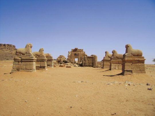
The Temple of Amun, dominating the city, displays the ideal ground plan of an Egyptian temple, with a main axis leading through an avenue of 12 statues of rams, a pylon, hypostyle hall, sanctuary and contra-temple; yet it shows typical Meroitic aspects in many of its details.
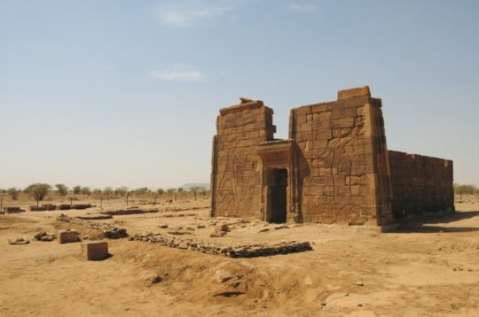
The very well preserved Lion Temple can be attributed to the Meroitic single room temple type; its reliefs on the outer and inner walls are among the finest examples of Meroitic two-dimensional art.
 © Naga-Projekt
 © Naga-Projekt
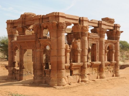
The Chapel of Hathor (formerly designated as the “Roman Kiosk”) merges Hellenistic/Roman and Egyptian architectural and decorative elements to create an autonomous Meroitic architectural creation. This diversity in form can be dated to the first half of the 1st century AD, under the reigns of king and queen Natakamani and Amanitore.
A generation later, under Amanikharekerema, Temple Naga 200 was built. It was possible to reconstruct its reliefs out of over 1,600 fallen blocks.
Various temples with a floor plan evoking a Greek peripteros have still to be excavated. All around the city centre – where living quarters have yet to be identified – lie vast necropolis with tumulus tombs. This is where excavations are planned for the upcoming years.
On the Gebel Naga overlooking the city are stone quarries from which the material for the city buildings was won. The greater part of the ancient city of Naga has not yet been explored and represents an archaeological potential of immense scientific significance.
Excavation House
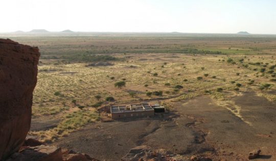
The project’s home base is the excavation house, built with funds from the firm Knauf: Westdeutsche Gipswerke. Bedrooms, common rooms and work areas are grouped around an inner courtyard; the restoration lab is situated in the forecourt. Containers serve as magazines for the finds. Generators and a small solar collector furnish electricity. Water is conveyed from the town of Shendi by tank truck once a week. Situated along the Nile, some 60 km away from Naga, Shendi is also the nearest shopping opportunity for foodstuffs and other necessities. Communication with the outside world is possible only by satellite phone, rarely also by mobile.
 © Naga-Projekt
UNESCO World Heritage
Naga is now a World Heritage Site; indeed, on June 25th, 2011, UNESCO’s World Heritage Committee added Naga to the list of World Heritage Sites. This was the culmination of the efforts of the Sudan’s National Corporation for Antiquities and Museums, which for many years has strived to achieve proper recognition for the sites of the Sudan – even among scholars much too little known and studied. No doubt Naga’s exemplary concept for the conservation and management of the site played an important part in UNESCO’s decision.
This decision is also an acknowledgement of the Meroitic Kingdom’s historical statues as a cultural bridge between the African and Mediterranean worlds, an aspect that is particularly apparent in this site and its archaeological treasures. Naga’s acceptance onto the list of World Heritage sites brings a practically unknown region and period of Antiquity into the spotlight, opening it up for research and making it better known to the public. It sets an important marker for the further exploration and conservation of historical sites in the Sudan and makes an important contribution to the cultural identity of the (as of July 11th, 2011) two Sudanese states.
More on this subject:
- UNESCO homepage: Archaeological Sites of the Island of Meroe
- UNESCO homepage: World Heritage Committee inscribes five new sites

